| UNESCO World Heritage Site | |
|---|---|
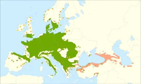
_valley_42.jpg.webp) Beușnița Waterfall in Nera Gorge-Beușnița National Park | |
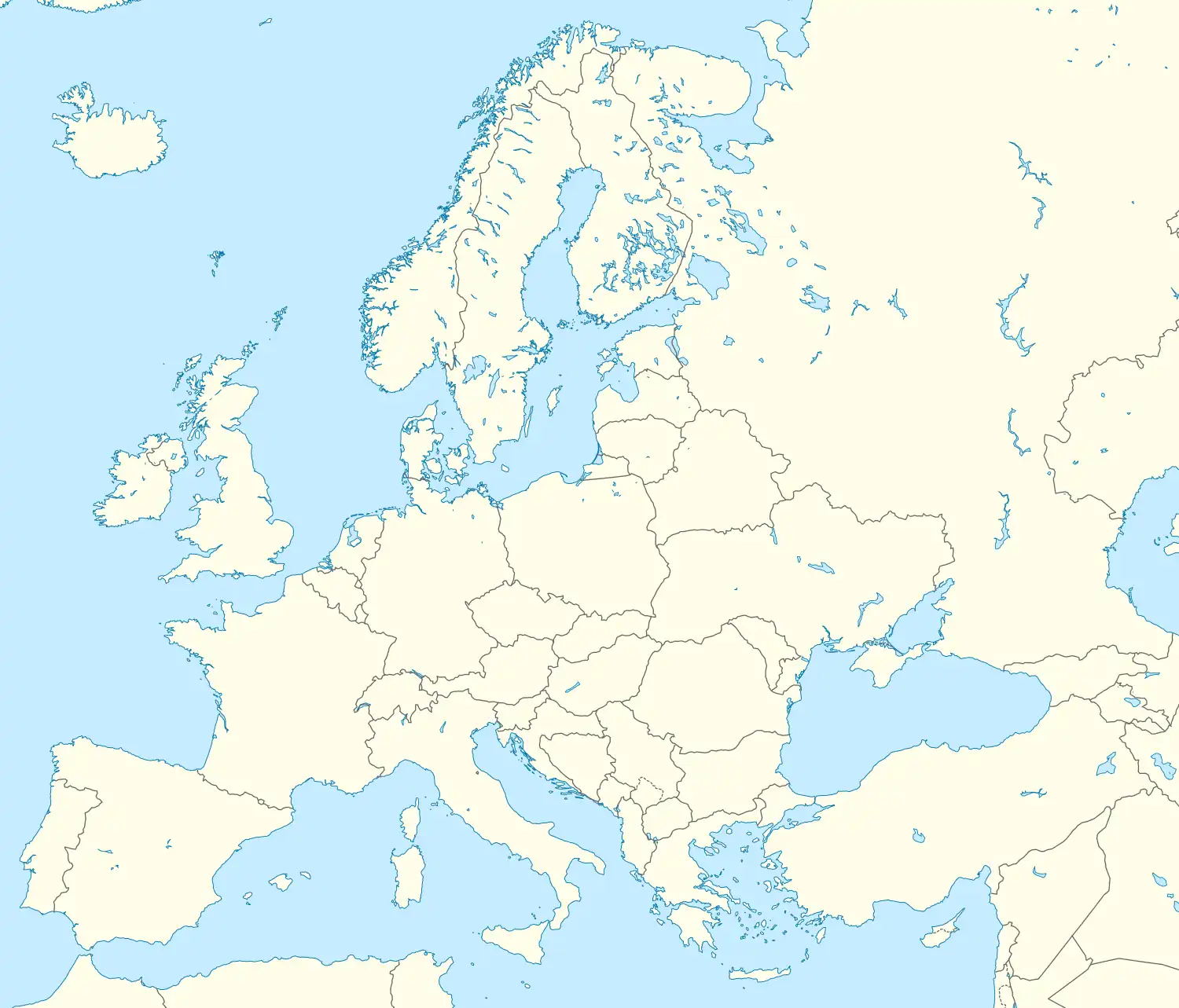
| Location | (see map) |
| Reference | 1133quater |
| Inscription | 2007 (31st Session) |
| Extensions | 2011, 2017, 2021 |
Ancient and Primeval Beech Forests of the Carpathians and Other Regions of Europe is a transnational serial nature UNESCO World Heritage Site, encompassing 94 component parts (forests of European beech, Fagus sylvatica) in 18 European countries.[1][2] Together, the sites protect the largest and least disturbed forests dominated by the beech tree. In many of these stands (especially those in the Carpathians), these forests here were allowed to proceed without interruption or interference since the last ice age. These sites document the undisturbed postglacial repopulation of the species.[1]
Carpathian region
The Primeval Beech Forests of the Carpathians include ten separate massifs located along the 185 km (115 mi) long axis from the Rakhiv mountains and Chornohora ridge in Ukraine over the Poloniny Ridge (Slovakia) to the Vihorlat Mountains in Slovakia. The Ancient Beech Forests of Germany include five locations, cover 4,391 hectares and were added in 2011.
The Carpathian site covers a total area of 77,971.6 ha (192,672 acres), out of which only 29,278.9 ha (72,350 acres) are part of the actual preserved area, while the rest is considered a "buffer zone". Primeval Beech Forests of the Carpathians cover areas of Zakarpattia and Prešov Regions. Over 70% of the site is located in Ukraine. The area includes two national parks, and some habitat controlled areas, mostly in Slovakia. Both national parks, along with a neighboring area in Poland, compose a separate biosphere reserve, the East Carpathian Biosphere Reserve. Besides Havešová, Rožok, and Stužica (all of them located in Bukovské vrchy), there is a fourth component situated in Slovakia, named Kyjovský prales of Vihorlat. Ukrainian locations include Chornohora, Kuziy-Trybushany, Maramarosh, Stuzhytsia–Uzhok, Svydovets, and Uholka–Shyrikyi Luh. Only a few of the ten components are accessible to visitors. Stužica is the only one of three locations in Bukovské vrchy (Slovakia) with available hiking trails. In 2017, UNESCO extended the site, adding forests in Albania, Austria, Belgium, Bulgaria, Croatia, Italy, Romania, Slovenia, and Spain.[3] In 2021 UNESCO extended the site again adding forests in Bosnia and Herzegovina, Czechia, France, Italy, North Macedonia, Poland, Slovakia and Switzerland.[4]
The last intact virgin forest in the temperate latitudes of Europe is to be found in the Carpathians. Trees can live to a hundred years old in these forests, providing an important habitat for organisms such as mushrooms, moss, lichen, insects, rare birds (e.g. capercaillie and black grouse) and mammals (e.g. bats, brown bear, wolf and lynx). Large parts of the forest in the Romanian part of the Carpathians have been lost due to deforestation. The pressure on timber as a resource may increase due to international demand and European companies may start large-scale felling in neighbouring Ukraine. Currently unprotected areas of virgin forest can be permanently preserved in the Ukrainian Carpathians by expanding and reinforcing conservation areas. In the Ukrainian Carpathians there are nine national parks and two biosphere reserves. There is a general ban on tree felling in coniferous forest areas above 1,100 metres. If park administrations are shown to work, management of larger, previously unprotected areas of virgin forest to preserve them on a permanent basis, may occur. There are roughly 100,000 additional hectares of forest which could be integrated into the existing conservation areas.[5]
List of component parts
The component parts included in the site as of August 2021 are:[1][6][7][8][9][10][11][12][13][2]
* Only boundary modification.
Udava (Bukovské Vrchy, Slovakia) was created by modifying the boundary of Stužica before. Falascone (Italy) in turn was named previously Umbra Forest (Foresta Umbra).[12][13][2]
This is a transnational serial nature UNESCO World Heritage Site, encompassing 94 component parts (forests) in 18 European countries.[1][2] The total area of component parts is 98,125.15 ha (242,472.5 acres), including buffer zones 392,846.02 ha (970,743.7 acres). The largest total area of component parts is in Ukraine and Romania – 54% total (41% including buffer zones).
Forms of protection
Component parts of this property overlap more or less with various protected areas like national parks, nature reserves, Natura 2000 network.[14][15][16][10][12][17][18]
Abbreviations:
C – count of component parts in a given cluster
N – overlapping with Natura 2000 areas
| Country | Component cluster | C | Protected area | N | Region |
|---|---|---|---|---|---|
| Albania | Lumi i Gashit | 1 | Strict nature reserve of Gashi River | Kukës | |
| Rrajca | 1 | Shebenik – Jabllanicë National Park | Elbasan | ||
| Austria | Dürrenstein | 1 | Wilderness Area Dürrenstein | Yes | Lower Austria |
| Kalkalpen | 4 | Kalkalpen National Park | Yes | Upper Austria | |
| Belgium | Sonian Forest (Forêt de Soignes) | 5 | 3 strict forest reserves within Sonian Forest Protected Landscape – “Joseph Zwaenepoel”, Grippensdelle and Ticton | Yes | Flanders, Brussels Capital Region, Wallonia |
| Bosnia and Herzegovina | Prašuma Janj | 1 | Prašuma Janj strict nature reserve | Bosanska Krajina | |
| Bulgaria | Central Balkan | 9 | 9 strict reserves in the Central Balkan National Park – Boatin, Dzhendema, Kozya stena, Peeshti skali[n 9], Severen Dzhendem, Sokolna, Stara reka, Steneto and Tsarichina | Yes | Lovech, Plovdiv, Stara Zagora, Gabrovo (central Balkan Mountains) |
| Croatia | Hajdučki i Rožanski kukovi | 1 | Hajdučki and Rožanski Kukovi strict reserve within Northern Velebit National Park | Yes | Lika-Senj |
| Paklenica National Park | 2 | Paklenica National Park | Yes | Lika-Senj, Zadar (Dinaric region, or Dinaric Alps) | |
| Czech Republic | Jizera Mountains | 1 | Jizerskohorské bučiny National Nature Reserve | Yes | Liberec |
| France | Chapitre | 1 | Chapitre-Petit-Buëch biological strict reserve | Yes | Provence-Alpes-Côte d'Azur |
| Grand Ventron | 1 | Massif du Grand Ventron National Nature Reserve | Yes | Grand Est | |
| Massane | 1 | Massane National Nature Reserve | Yes | Occitanie | |
| Germany | Grumsin | 1 | Schorfheide-Chorin Biosphere Reserve | Yes | Brandenburg |
| Hainich | 1 | Hainich National Park | Yes | Thuringia | |
| Jasmund | 1 | Jasmund National Park | Yes | Mecklenburg-Vorpommern | |
| Kellerwald | 1 | Kellerwald-Edersee National Park | Yes | Hesse | |
| Serrahn | 1 | Müritz National Park | Yes | Mecklenburg-Vorpommern | |
| Italy | Abruzzo, Lazio & Molise | 5 | Abruzzo, Lazio and Molise National Park | Yes | Abruzzo |
| Umbra Forest (Foresta Umbra) | 2 | Strict reserves within Gargano National Park – Sfilzi, Falascone and Foresta Umbra | Yes | Apulia | |
| Monte Cimino | 1 | Regional Natural Monument and municipal strict reserve | Yes | Lazio | |
| Monte Raschio | 1 | Regional Natural Park Bracciano-Martignano | Yes | Lazio | |
| Pollino National Park | 2 | Cozzo Ferriero and Pollinello strict reserves within Pollino National Park | Yes | Calabria, Basilicata | |
| Sasso Fratino | 1 | Sasso Fratino strict reserve in Foreste Casentinesi, Monte Falterona, Campigna National Park | Yes | Emilia-Romagna, Tuscany | |
| Infernale Valley (Valle Infernale) | 1 | Valle Infernale strict reserve within Aspromonte National Park | Yes | South Calabria | |
| North Macedonia | Dlaboka Reka | 1 | Forest reserves within Mavrovo National Park | Mavrovo and Rostuša and Gostivar | |
| Poland | Bieszczady | 4 | Bieszczady National Park, East Carpathian Biosphere Reserve | Yes | Podkarpackie Voivodeship |
| Romania | Cheile Nerei-Beușnița | 1 | Strictly protected zone of the Cheile Nerei-Beușnița National Park | Yes | Caraș-Severin |
| Sinca secular forest (Codrul secular Șinca) | 1 | Strictly protected through the forest management plan | Yes | Brașov | |
| Slătioara secular forest (Codrul secular Slătioara) | 1 | Part of Codrul Secular Slătioara forest reserve, Secular Meadows Todirescu floristic reserve | Yes | Suceava | |
| Cozia | 2 | Cozia National Park | Yes | Vâlcea | |
| Domogled – Valea Cernei | 3 | Domogled-Valea Cernei National Park | Yes | Mehedinți, Caraș-Severin, Gorj | |
| Groșii Țibleșului | 2 | Strictly protected through the forest management plan | Yes | Maramureș | |
| Izvoarele Nerei | 1 | Izvoarele Nerei strict reserve within Semenic-Cheile Carașului National Park | Yes | Caraș-Severin | |
| Strâmbu Băiuț[n 3] | 1 | Strictly protected through the forest management plan | Yes | Maramureș | |
| Slovakia | Poloniny | 4 | National nature reserves Stužica, Jarabá skala, Pľaša and Borsukov vrch (Stužica – Bukovské Vrchy), Rožok, Havešová, nature reserve Udava within Poloniny National Park, East Carpathian Biosphere Reserve | Yes | Prešov |
| Vihorlat | 1 | Vihorlat national nature reserve within Vihorlat Protected Landscape Area | Yes | Prešov | |
| Slovenia | Krokar | 1 | Forest reserve Virgin forest Krokar | Yes | Kočevje |
| Snežnik–Ždrocle | 1 | Snežnik–Ždrocle forest reserve | Yes | Inner Carniola | |
| Spain | Beech forests of Ayllón (Hayedos de Ayllón) | 2 | Tejera Negra: Sierra Norte de Guadalajara Natural Park, Montejo: Sierra del Rincón Biosphere Reserve | Yes | Castilla-La Mancha |
| Beech forests of Navarra (Hayedos de Navarra) | 2 | Integral (strict) reserves of Lizardoia and Aztaparreta | Yes | Navarre | |
| Beech forests of Picos de Europa (Hayedos de Picos de Europa) | 2 | Picos de Europa National Park, Biosphere Reserve | Yes | Castile and León | |
| Switzerland | Bettlachstock Forest (Forêt de la Bettlachstock) | 1 | Forest reserve Bettlachstock–Hasenmatt | Canton of Solothurn | |
| Forest reserves of Lodano, Busai and Soladino Valleys | 1 | Lodano Valley forest reserve, Busai and Soladino Valleys forest reserve | Canton of Ticino | ||
| Ukraine | Chornohora | 1 | Carpathian Biosphere Reserve | Zakarpattia | |
| Kuziy – Trybushany | 1 | Carpathian Biosphere Reserve | Zakarpattia | ||
| Maramarosh | 1 | Carpathian Biosphere Reserve | Zakarpattia | ||
| Stuzhytsia – Uzhok | 1 | Uzhanian National Nature Park | Zakarpattia | ||
| Svydovets | 1 | Carpathian Biosphere Reserve | Zakarpattia | ||
| Uholka – Shyrokyi Luh[n 2] | 1 | Carpathian Biosphere Reserve | Zakarpattia | ||
| Synevyr | 4 | Synevyr National Nature Park | Zakarpattia | ||
| Zacharovanyi Krai | 2 | Zacharovany Krai National Nature Park | Zakarpattia | ||
| Gorgany | 1 | Gorgany Nature Reserve | Ivano-Frankivsk | ||
| Roztochchya[n 6] | 1 | Roztochchya Nature Reserve, Roztochia Biosphere Reserve | Lviv | ||
| Satanіvska Dacha | 1 | Podilski Tovtry National Nature Park | Khmelnytskyi |
Tentative list
This forest is placed on the World Heritage Tentative list as a proposal for the expansion of the Ancient and Primeval Beech Forests of the Carpathians and Other Regions of Europe site:
Montenegro[19]
- Virgin Forest Reserve in NP Biogradska Gora
Serbia[11]
Gallery
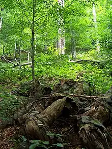 Forest in Stuzica
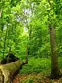 Havešová
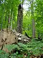 Stužica
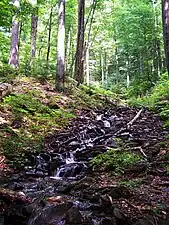 Freshwater stream in Stužica
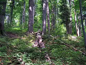 Stužica
 Dlaboka Reka
Notes
- ↑ Geographic coordinates corrected from "N49 4 14 E22 3 1" to N49°4’58’’ E22°35’45’’
- 1 2 "Uholka-Shyrikyi Luh" corrected to "Uholka-Shyrokyi Luh".
- 1 2 "Strimbu Băiuț" changed to "Strâmbu Băiuț".
- ↑ "Gorna Solinka" corrected to "Górna Solinka".
- ↑ "Polonina Wetlinska" corrected to "Połonina Wetlińska".
- 1 2 "Roztochya" corrected to "Roztochchya".
- ↑ "Stara reka Reserve[9][11]" corrected to "Steneto Reserve[6][9]".
- ↑ "Severen Dzhendem Reserve[9][11]" corrected to "Stara Reka Reserve[6][9]".
- 1 2 "Peesh skali" corrected to "Peeshti skali".
- ↑ Latitude corrected from "N41 143" to N41°14’43’’
References
- 1 2 3 4 "Ancient and Primeval Beech Forests of the Carpathians and Other Regions of Europe". UNESCO. Retrieved 29 July 2021.
- 1 2 3 4 UNITED NATIONS EDUCATIONAL, SCIENTIFIC AND CULTURAL ORGANIZATION; CONVENTION CONCERNING THE PROTECTION OF THE WORLD CULTURAL AND NATURAL HERITAGE; WORLD HERITAGE COMMITTEE (31 July 2021). "WHC/21/44.COM/18; Decisions adopted during the extended 44th session of the World Heritage Committee (Fuzhou (China) / Online meeting, 2021); 8B. NOMINATIONS TO THE WORLD HERITAGE LIST; Decision: 44 COM 8B.32" (PDF). World Heritage. Vol. 44 COM, Extended forty-fourth session, Fuzhou (China) / Online meeting, 16 - 31July 2021. Paris: UNESCO. pp. 368–372. Retrieved 3 December 2021.
{{cite book}}: CS1 maint: multiple names: authors list (link) - ↑ "Unesco approves the extension of the Carpathian Primary Beech forests".
- ↑ "Decisions adopted during the extended 44th session of the World Heritage Committee" (PDF). 31 July 2021.
- ↑ "Protecting virgin forest in the Ukrainian Carpathians". 21 June 2021.
- 1 2 3 Jovanović, Ivana; Dragišić, Aleksandar; Ostojić, Dragana; Krsteski, Biljana (2019). "BEECH FORESTS AS WORLD HERITAGE IN ASPECT TO THE NEXT EXTENSION OF THE ANCIENT AND PRIMEVAL BEECH FORESTS OF THE CARPATHIANS AND OTHER REGIONS OF EUROPE WORLD HERITAGE SITE". Nature Conservation. 69 (1–2): 15–32. Retrieved 2 August 2021.
- ↑ UNITED NATIONS EDUCATIONAL, SCIENTIFIC AND CULTURAL ORGANIZATION; CONVENTION CONCERNING THE PROTECTION OF THE WORLD CULTURAL AND NATURAL HERITAGE; WORLD HERITAGE COMMITTEE (11 May 2007). "WHC-07/31.COM/8B; Item 8B of the Provisional Agenda: Nominations to the World Heritage List" (PDF). World Heritage. Vol. 31.COM: Thirty first Session, Christchurch, New Zealand, 23 June – 2 July 2007. Paris: UNESCO. Retrieved 7 August 2021.
{{cite book}}: CS1 maint: multiple names: authors list (link) - ↑ UNITED NATIONS EDUCATIONAL, SCIENTIFIC AND CULTURAL ORGANIZATION; CONVENTION CONCERNING THE PROTECTION OF THE WORLD CULTURAL AND NATURAL HERITAGE; WORLD HERITAGE COMMITTEE (6 May 2011). "WHC-11/35.COM/8B; 8B. Nominations to the World Heritage List" (PDF). World Heritage. Vol. 35.COM: Thirty-fifth session, Paris, UNESCO Headquarters, 19 – 29 June 2011. Paris: UNESCO. Retrieved 7 August 2021.
{{cite book}}: CS1 maint: multiple names: authors list (link) - 1 2 3 4 5 UNITED NATIONS EDUCATIONAL, SCIENTIFIC AND CULTURAL ORGANIZATION; CONVENTION CONCERNING THE PROTECTION OF THE WORLD CULTURAL AND NATURAL HERITAGE WORLD HERITAGE COMMITTEE (19 May 2017). "WHC/17/41.COM/8B; 8B. Nominations to the World Heritage List" (PDF). World Heritage. Vol. 41.COM: Forty first session, Krakow, Poland, 2 12 July 2017. Paris: UNESCO. Retrieved 7 August 2021.
{{cite book}}: CS1 maint: multiple names: authors list (link) - 1 2 "Primeval Beech Forests of the Carpathians and Other Regions of Europe" as extension to the existing Natural World Heritage Site "Primeval Beech Forests of the Carpathians and the Ancient Beech Forests of Germany" (1133bis). NOMINATION DOSSIER to the UNESCO for the Inscription on the World Heritage List. IUCN. January 2017. Retrieved 7 August 2021.
- 1 2 3 4 UNITED NATIONS EDUCATIONAL, SCIENTIFIC AND CULTURAL ORGANIZATION; CONVENTION CONCERNING THE PROTECTION OF THE WORLD CULTURAL AND NATURAL HERITAGE; WORLD HERITAGE COMMITTEE (4 June 2021). "WHC/21/44.COM/8B; 8B. Nominations to the World Heritage List". World Heritage. Vol. 31.COM: Extended forty-fourth session, Fuzhou (China) / Online meeting, 16 – 31 July 2021. Paris: UNESCO. Retrieved 7 August 2021.
{{cite book}}: CS1 maint: multiple names: authors list (link) - 1 2 3 'Ancient and Primeval Beech Forests of the Carpathians and Other Regions of Europe' as extension to the existing Natural World Heritage Site 'Ancient and Primeval Beech Forests of the Carpathians and Other Regions of Europe' (1133ter). Nomination Dossier to the UNESCO for the Inscription on the World Heritage List. IUCN. January 2020. Retrieved 7 August 2021.
- 1 2 "ANCIENT AND PRIMEVAL BEECH FORESTS OF THE CARPATHIANS AND OTHER REGIONS OF EUROPE; BOSNIA AND HERZEGOVINA, CZECHIA, FRANCE, ITALY, MONTENEGRO, NORTH MACEDONIA, POLAND, SERBIA, SLOVAKIA, SWITZERLAND – ID N° 1133quater". IUCN World Heritage Evaluations 2021 (WHC/21/44.COM/INF.8B2.ADD); ADDENDUM: IUCN Evaluations of nominations of natural and mixed properties to the World Heritage List; IUCN REPORT FOR THE WORLD HERITAGE COMMITTEE, extended 44th Session, 16-31 JULY 2021, Fu zhou (CHina) / online. IUCN. May 2021. pp. 5–26. Retrieved 7 August 2021.
- ↑ BEECH PRIMEVAL FORESTS OF THE CARPATHIANS. Nomination dossier 2007 to the UNESCO for the Inscription on the World Heritage List; Nomination of the "Ancient Beech Forests of Germany" as Extension to the World Natural Heritage "Primeval Beech Forests of the Carpathians" (1133). Nomination Dossier 2011 to the UNESCO for the Inscription on the World Heritage List (PDF). IUCN. 2011 [2007]. Retrieved 14 August 2021.
- ↑ WORLD HERITAGE NOMINATION – IUCN TECHNICAL EVALUATION PRIMEVAL BEECH FORESTS OF THE CARPATHIANS (SLOVAKIA AND UKRAINE) – ID No. 1133. IUCN. May 2007. Retrieved 14 August 2021.
- ↑ WORLD HERITAGE NOMINATION – IUCN TECHNICAL EVALUATION ANCIENT BEECH FORESTS OF GERMANY (GERMANY) – ID No. 1133 bis (Extension of Primeval Beech Forests of the Carpathians, Slovakia and Ukraine). IUCN. May 2011. Retrieved 14 August 2021.
- ↑ "Sonianforest". Foundation Sonian Forest. Retrieved 14 August 2021.
- ↑ "Natura 2000 Network Viewer". European Environment Agency. Retrieved 14 August 2021.
- ↑ "Ancient and Primeval Beech Forests of the Carpathians and Other Regions of Europe (Montenegro)". UNESCO. Retrieved 3 July 2018.
External links
- "Ancient and Primeval Beech Forests of the Carpathians and Other Regions of Europe". UNESCO World Heritage Centre. Retrieved 28 September 2008.
- Beauty and changes of Primeval beech forests throughout a year
Flag of Albania | ||
1 with Austria, Belgium, Bosnia and Herzegovina, Croatia, Czech Republic, France, Germany, Italy, North Macedonia, Poland, Romania, Slovakia, Slovenia, Spain, Switzerland and Ukraine 2 This is the extension of the site that has been inscribed in North Macedonia since 1979. The area around the town of Pogradec at the shores of Lake Ohrid was inhabited by the Illyrians in the 5th century BC, followed by the Romans and the Slavs. Traces of the Roman road Via Egnatia are evidence of an important passage route in the region. The ruins of the paleo-christian church of Lin together with its floor mosaics reveal the presence of Christianity. The historical centre of Pogradec represents an example of 19th to 20th century Albanian vernacular architecture. | ||
| Flag of Belgium | |
1 Listing shared with six other countries, which includes Belgium's Maison Guiette; 2 Listing shared with France; 3 Listing shared with the Netherlands, which includes Belgium's Wortel; 4 Listing shared with France 5 Listing shared with seven other countries, which includes Belgium's Spa; 6 Listing shared with seventeen other countries, which includes Belgium's Sonian Forest. | ||
| ||
Flag of Bulgaria | ||
1 with Albania, Austria, Belgium, Bosnia and Herzegovina, Croatia, Czech Republic, France, Germany, Italy, North Macedonia, Poland, Romania, Slovakia, Slovenia, Spain, Switzerland and Ukraine | ||
| Flag of Croatia | |
| ||
| Flag of the Czech Republic | |
1 Shared with Germany; 2 Shared with six countries; 3 Shared with 17 countries | ||
Flag of North Macedonia | ||
1 shared with Albania; 2 shared with 17 countries | ||
| Cultural |
| |
|---|---|---|
| Natural | ||
| ||
| Cultural | ||
|---|---|---|
| Natural | ||
| Lake Geneva region | Flag of Switzerland | |
|---|---|---|
| Espace Mittelland | ||
| Eastern |
| |
| Ticino | ||
| Nationwide | ||
| ||
| Cultural |
| Lesser Coat of Arms of Ukraine |
|---|---|---|
| Natural | ||