Turbe | |
|---|---|
Village | |
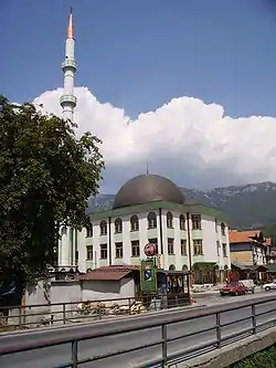 New mosque in Turbe | |
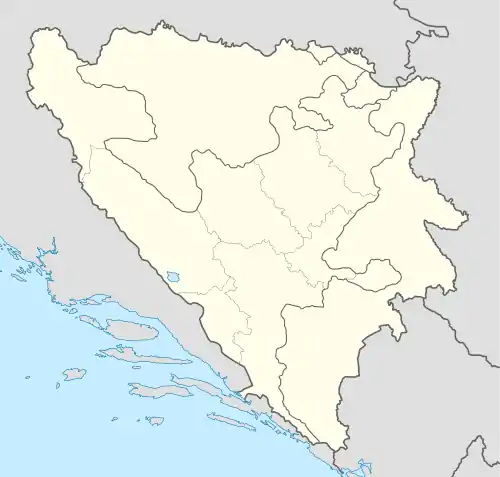  Turbe | |
| Coordinates: 44°14′N 17°34′E / 44.24°N 17.57°E | |
| Country |  Bosnia and Herzegovina Bosnia and Herzegovina |
| Entity | Federation of Bosnia and Herzegovina |
| Canton |  Central Bosnia Central Bosnia |
| Municipality |  Travnik Travnik |
| Area | |
| • Total | 0.95 sq mi (2.45 km2) |
| Highest elevation | 2,018 ft (615 m) |
| Lowest elevation | 1,952 ft (595 m) |
| Population (2013) | |
| • Total | 3,890 |
| • Density | 4,100/sq mi (1,600/km2) |
| Time zone | UTC+1 (CET) |
| • Summer (DST) | UTC+2 (CEST) |
| Area code | +387 (031) |
Turbe is a settlement in the Travnik municipality, Federation of Bosnia and Herzegovina, Bosnia and Herzegovina.[1][2] The name is derived from the Turkish türbe.
Population
| Turbe: Census Year 2013: Total of 3,890 inhabitants[3] | ||||||
| Census Year | 1991. | 1981. | 1971. | |||
| Bosniaks | 2.154 (47.35%) | 1.658 (47.11%) | 798 (43.94%) | |||
| Serbs | 1.056 (23.21%) | 774 (21.99%) | 486 (26.76%) | |||
| Croats | 886 (19.47%) | 731 (20.77%) | 454 (25.00%) | |||
| Yugoslavs | 309 (6.79%) | 322 (9.15%) | 60 (3.30%) | |||
| Others | 144 (3.16%) | 34 (0.96%) | 18 (0.99%) | |||
| Total | 4.549 | 3.519 | 1.816 | |||
See also
References
- ↑ Spahić M. et al. (2000): Bosna i Hercegovina (1:250.000). Izdavačko preduzeće „Sejtarija", Sarajevo., The Map
- ↑ Mučibabić B., Ed. (1998): Geografski atlas Bosne i Hercegovine. Geodetski zavod BiH, Sarajevo, ISBN 9958-766-00-0., pp: 4-5.
- ↑ "Naseljena Mjesta 1991/2013" (in Bosnian). Statistical Office of Bosnia and Herzegovina. Retrieved December 11, 2021.
- ↑ "Naselje Turbe". nasbih.com.
- ↑ "Nacionalni sastav stanovništva Republike Bosne i Hercegovine 1991. (str. 106)" (PDF). fzs.ba.
- ↑ "Nacionalni sastav stanovništva SFR Jugoslavije 1981" (PDF). stat.gov.rs.
- ↑ "Nacionalni sastav stanovništva SFR Jugoslavije 1971" (PDF). stat.gov.rs.
This article is issued from Wikipedia. The text is licensed under Creative Commons - Attribution - Sharealike. Additional terms may apply for the media files.