Barren Township | |
|---|---|
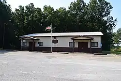 Barren Township Townhouse | |
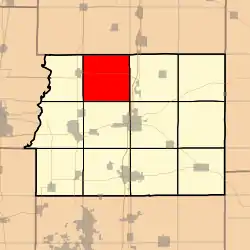 Location in Franklin County | |
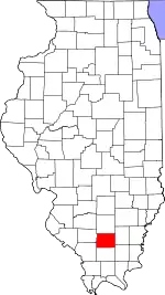 Franklin County's location in Illinois | |
| Coordinates: 38°05′13″N 88°59′34″W / 38.08694°N 88.99278°W | |
| Country | United States |
| State | Illinois |
| County | Franklin |
| Established | November 4, 1884 |
| Area | |
| • Total | 36.15 sq mi (93.6 km2) |
| • Land | 20.96 sq mi (54.3 km2) |
| • Water | 15.19 sq mi (39.3 km2) 42.02% |
| Elevation | 427 ft (130 m) |
| Population (2010) | |
| • Estimate (2016)[1] | 492 |
| • Density | 23.7/sq mi (9.2/km2) |
| Time zone | UTC-6 (CST) |
| • Summer (DST) | UTC-5 (CDT) |
| ZIP codes | 62812, 62884, 62897 |
| FIPS code | 17-055-03818 |
Barren Township is one of twelve townships in Franklin County, Illinois, USA. As of the 2010 census, its population was 496 and it contained 224 housing units.[2]
Geography
According to the 2010 census, the township has a total area of 36.15 square miles (93.6 km2), of which 20.96 square miles (54.3 km2) (or 57.98%) is land and 15.19 square miles (39.3 km2) (or 42.02%) is water.[2]
Cities, towns, villages
- Sesser (east edge)
Cemeteries
The township contains Hammond Cemetery.
Major highways
Lakes
Landmarks
Demographics
| Census | Pop. | Note | %± |
|---|---|---|---|
| 2016 (est.) | 492 | [1] | |
| U.S. Decennial Census[3] | |||
School districts
- Sesser-Valier Community Unit School District 196
Political districts
- Illinois's 12th congressional district
- State House District 117
- State Senate District 59
References
- "Barren Township, Franklin County, Illinois". Geographic Names Information System. United States Geological Survey, United States Department of the Interior. Retrieved January 16, 2010.
- United States Census Bureau 2007 TIGER/Line Shapefiles
- United States National Atlas
- 1 2 "Population and Housing Unit Estimates". Retrieved June 9, 2017.
- 1 2 "Population, Housing Units, Area, and Density: 2010 - County -- County Subdivision and Place -- 2010 Census Summary File 1". United States Census. Archived from the original on February 12, 2020. Retrieved May 28, 2013.
- ↑ "Census of Population and Housing". Census.gov. Retrieved June 4, 2016.
Adjacent townships
- Elk Prairie Township, Jefferson County (north)
- Spring Garden Township, Jefferson County (northeast)
- Ewing Township (east)
- Benton Township (southeast)
- Browning Township (south)
- Tyrone Township (southwest)
- Goode Township (west)
- Bald Hill Township, Jefferson County (northwest)
External links
Places adjacent to Barren Township, Franklin County, Illinois | |
|---|---|
Municipalities and communities of Franklin County, Illinois, United States | ||
|---|---|---|
| Cities | Map of Illinois highlighting Franklin County | |
| Villages | ||
| Townships | ||
| CDP | ||
| Other unincorporated communities | ||
| Footnotes | ‡This populated place also has portions in an adjacent county or counties | |
This article is issued from Wikipedia. The text is licensed under Creative Commons - Attribution - Sharealike. Additional terms may apply for the media files.