| Fang Peak | |
|---|---|
 | |
| Highest point | |
| Elevation | 2,302 m (7,552 ft) |
| Prominence | 312 m (1,024 ft) |
| Coordinates | 51°27′51.8″N 125°59′12.8″W / 51.464389°N 125.986889°W |
| Geography | |
| Location | British Columbia, Canada |
| District | Range 2 Coast Land District |
| Parent range | Pacific Ranges |
| Topo map | NTS 92N5 Klinaklini Glacier |
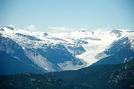
Fang Peak is a mountain in southwestern British Columbia, Canada, located 91 km (57 mi) east of Rivers Inlet and 8 km (5 mi) southeast of Mount Fitzgerald.[1]
Fang Peak lies on the eastern rim of a circular volcanic depression in the Pacific Ranges of the Coast Mountains called the Silverthrone Caldera.
References
- ↑ "Fang Peak". Bivouac.com.
This article is issued from Wikipedia. The text is licensed under Creative Commons - Attribution - Sharealike. Additional terms may apply for the media files.