| Great Eastern Pingo Trail | |
|---|---|
 | |
| Type | Local Nature Reserve |
| Location | North Walsham, Norfolk |
| OS grid | TL 929 934 |
| Area | 4.2 hectares (10 acres) |
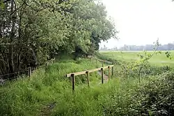
Great Eastern Pingo Trail is a 9.2 kilometres (5.7 miles) long footpath along a disused railway line north of Thetford in Norfolk.[1][2] It is a 4.2-hectare (10-acre) Local Nature Reserve,[3][4] and it crosses three Sites of Special Scientific Interest, Thompson Water, Carr and Common, Breckland Forest and Cranberry Rough, Hockham.[5][6][7] It also crosses Thompson Common, which is a nature reserve managed by the Norfolk Wildlife Trust[8] and is a Nature Conservation Review site, Grade I.[9] It further crosses Norfolk Valley Fens Special Area of Conservation[10] and Breckland Special Protection Area.[11]
This site has around 300 pingos, shallow pools formed when ice melted at the end of the last ice age. There is a mosaic of habitats with a large lake, Thompson Water, at the western end.[3][1]

References
- 1 2 "The Pingo Trail Walk". Explore Norfolk. Retrieved 25 June 2018.
- ↑ "Great Eastern Pingo Trail". AA. Retrieved 25 June 2018.
- 1 2 "Great Eastern Pingo Trail". Local Nature Reserves. Natural England. Retrieved 25 June 2018.
- ↑ "Map of Great Eastern Pingo Trail". Local Nature Reserves. Natural England. Retrieved 25 June 2018.
- ↑ "Designated Sites View: Thompson Water, Carr and Common". Sites of Special Scientific Interest. Natural England. Retrieved 21 May 2018.
- ↑ "Designated Sites View: Breckland Forest". Sites of Special Scientific Interest. Natural England. Retrieved 4 June 2018.
- ↑ "Designated Sites View: Cranberry Rough, Hockham". Sites of Special Scientific Interest. Natural England. Retrieved 4 June 2018.
- ↑ "Thompson Common". Norfolk Wildlife Trust. Retrieved 4 June 2018.
- ↑ Ratcliffe, Derek, ed. (1977). A Nature Conservation Review. Vol. 2. Cambridge, UK: Cambridge University Press. pp. 138–39. ISBN 0521-21403-3.
- ↑ "Designated Sites View: Norfolk Valley Fens". Special Area of Conservation. Natural England. Retrieved 25 May 2018.
- ↑ "Designated Sites View: Breckland". Special Protection Area. Natural England. Retrieved 25 May 2018.