Provincial Trunk Highway 83 | ||||
|---|---|---|---|---|
| Route information | ||||
| Maintained by Department of Infrastructure | ||||
| Length | 402 km (250 mi) | |||
| Existed | 1953–present | |||
| Major junctions | ||||
| South end |  US 83 at the Westhope–Coulter Border Crossing US 83 at the Westhope–Coulter Border Crossing | |||
| North end |  PTH 10 in Swan River PTH 10 in Swan River | |||
| Location | ||||
| Country | Canada | |||
| Province | Manitoba | |||
| Rural municipalities | ||||
| Towns | ||||
| Highway system | ||||
| ||||


Provincial Trunk Highway 83 (PTH 83) is a major north-south highway that runs in the far western region of the Canadian province of Manitoba. It travels from the North Dakota border south of Melita, north through Virden, Birtle, Russell, and Roblin to its northern terminus with PTH 10 in the town of Swan River. Along with US 83, PTH 83 is part of a continuously numbered north-south highway in North America with a combined distance of 3,450 kilometres (2,140 mi).
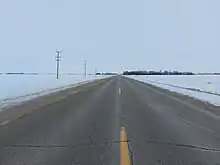
PTH 83 travels no further than 32 kilometres (20 mi) east of the Saskatchewan border, and comes within 2 kilometres (1.2 mi) of the provincial boundary from the junction with PR 487 just north of Benito to the junction with PTH 57.
History
PTH 83 first appeared on the 1953 Manitoba Highway Map.[1]
Prior to 1953, PTH 83 was originally numbered as Highway 22. In 1953, the government re-designated it to match U.S. Route 83. As well, the current section of the highway between Russell and Swan River was known as Highway 31.[2]
Originally, the highway's northern terminus was at the Trans-Canada Highway in Virden, making the original length of the highway 104 kilometres (65 mi). The section of PTH 83 between the Trans-Canada Highway and Birtle was opened to traffic in 1954. At the same time, the highway was extended to Swan River, replacing Highway 31.
A small portion of PTH 83 between Roblin and Russell was reconstructed due to a large slide that occurred in early July 2012. The area affected was located one kilometre north of PR 366 at the bottom of the Shell Valley with traffic detoured around that portion of highway. The slide became serious enough to close the road on July 2. The area which was closed had encountered numerous slides in previous years. It was once home to a lookout point over the Assessippi Valley. That lookout point was declared unsafe and was closed during a previous partial collapse of the road.[3]
Major intersections
| Division | Location | km | mi | Destinations | Notes | |||
|---|---|---|---|---|---|---|---|---|
| Two Borders | | 0 | 0.0 |  US 83 south – Minot, Bismarck US 83 south – Minot, Bismarck | Continuation into North Dakota | |||
| Canada–United States border at Westhope–Coulter Border Crossing | ||||||||
| | 8 | 5.0 |  PR 251 west – Lyleton PR 251 west – Lyleton | South end of PR 251 concurrency | ||||
| | 12 | 7.5 | PR 251 east – Waskada | North end of PR 251 concurrency | ||||
| | 22 | 14 |  PTH 3 west (Boundary Commission Trail) – Pierson, Estevan PTH 3 west (Boundary Commission Trail) – Pierson, Estevan | South end of PTH 3 concurrency | ||||
| Town of Melita | 35 | 22 |  PR 445 west PR 445 west | |||||
| 36 | 22 | PTH 3 east (Boundary Commission Trail) – Deloraine, Medora | North end of PTH 3 concurrency | |||||
| Two Borders | | 43 | 27 |  PR 452 east – Napinka PR 452 east – Napinka | ||||
| | 51 | 32 |  PR 345 – Tilston, Lauder PR 345 – Tilston, Lauder | |||||
| Pipestone | Pipestone | 69 | 43 |  PTH 2 (Red Coat Trail) – Reston, Souris PTH 2 (Red Coat Trail) – Reston, Souris | ||||
| | 87 | 54 |  PR 255 – Cromer, Oak Lake Beach PR 255 – Cromer, Oak Lake Beach | |||||
| Wallace – Woodworth |
No major junctions | |||||||
| Town of Virden | 100 | 62 |  PR 257 – Kola, Virden PR 257 – Kola, Virden | |||||
| Wallace – Woodworth | | 104 | 65 |  PR 259 east – Kenton PR 259 east – Kenton PTH 1 (TCH) east – Brandon PTH 1 (TCH) east – Brandon | South end of PTH 1 concurrency | |||
| | 110 | 68 | PTH 1 (TCH) west – Regina | North end PTH 1 west concurrency | ||||
| | 116 | 72 | Mile 66N | Former PR 441 west | ||||
| Prairie View | | 133 | 83 |  PR 467 west – Willen PR 467 west – Willen | ||||
| | 134 | 83 | Crosses the Assiniboine River | |||||
| Miniota | 137 | 85 |  PTH 24 east – Oak River PTH 24 east – Oak River | |||||
| | 152 | 94 |  PR 355 – Birdtail Sioux, Isabella PR 355 – Birdtail Sioux, Isabella | |||||
| | 163 | 101 |  PR 568 west PR 568 west | |||||
| Birtle | 169 | 105 |  PTH 42 east – Shoal Lake PTH 42 east – Shoal Lake | South end of PTH 42 concurrency | ||||
| | 172 | 107 | PTH 42 west – St. Lazare | North end of PTH 42 concurrency | ||||
| | 182 | 113 |   PTH 16 (TCH) east / YH – Shoal Lake PTH 16 (TCH) east / YH – Shoal Lake | South end of PTH 16 concurrency | ||||
| Foxwarren | 189 | 117 |  PR 475 west PR 475 west | |||||
| Prairie View–Russell – Binscarth boundary | | 200 | 120 |  PR 359 east – Rossburn PR 359 east – Rossburn | ||||
| Russell – Binscarth | | 201 | 125 |  PTH 41 south – St. Lazare PTH 41 south – St. Lazare | ||||
| Binscarth | 204 | 127 |  PR 478 – Esterhazy PR 478 – Esterhazy | |||||
| | 214 | 133 | Mile 116N | Former PR 479 east | ||||
| | 217 | 135 |  PR 579 west – Millwood PR 579 west – Millwood | |||||
| Russell | 220 | 140 |  PTH 45 east – Rossburn PTH 45 east – Rossburn | |||||
| 221 | 137 | PTH 16 (TCH) west / YH – Yorkton, Saskatoon | North end of PTH 16 concurrency | |||||
| | 231 | 144 |  PR 264 east – Rossburn PR 264 east – Rossburn | Former PR 254 east | ||||
| Riding Mountain West | | 241 | 150 |  PR 482 north – Asessippi Provincial Park PR 482 north – Asessippi Provincial Park | ||||
| | 243 | 151 |  PR 366 east – Inglis, Grandview PR 366 east – Inglis, Grandview | |||||
| | 245 | 152 | Crosses the Shell River | |||||
| Roblin | | 257 | 160 | Mile 141N | Former PR 589 east | |||
| | 271 | 168 |  PR 583 east PR 583 east | |||||
| Roblin | 276 | 171 |  PTH 5 (Parks Route) – Yorkton, Dauphin PTH 5 (Parks Route) – Yorkton, Dauphin | Inspections off-set; PTH 5 concurrency (200m) across the CNR tracks | ||||
| | 279 | 173 | Mile 153N | Former PR 594 east | ||||
| | 280 | 170 |  PR 593 west PR 593 west | |||||
| | 289 | 180 | Mile 180N | Former PR 483 east | ||||
| | 295 | 183 |  PR 594 north – Duck Mountain Provincial Park PR 594 north – Duck Mountain Provincial Park | |||||
| | 299 | 186 | Mile 169W | Former PR 592 south | ||||
| | 302 | 188 |  PR 363 west – Togo PR 363 west – Togo | |||||
| | 312 | 194 |  PR 367 east – Duck Mountain Provincial Park PR 367 east – Duck Mountain Provincial Park | |||||
| Duck Mountain Provincial Forest | | 333 | 207 |  PTH 57 west – Madge Lake PTH 57 west – Madge Lake | ||||
| Swan Valley West | | 349 | 217 | Mile 192N (Alpine Road) | Former PR 586 north | |||
| | 359 | 223 |  PTH 49 west – Arran PTH 49 west – Arran | |||||
| Benito | 362 | 225 | ||||||
| | 366 | 227 |  PR 487 north PR 487 north | Former PR 588 north | ||||
| | 374 | 232 |  PR 486 east – Durban PR 486 east – Durban | Former PR 586 south | ||||
| Kenville | 387 | 240 | PR 487 west | |||||
| | 394 | 245 | PR 486 south | |||||
| | 397 | 247 |  PTH 83A north – Swan River PTH 83A north – Swan River | |||||
| Town of Swan River | 402 | 250 | PTH 10 (NWWR) – The Pas, Dauphin PTH 10A north / PTH 83A south (Main Street E.) – Swan River (Town Center) PTH 10A north / PTH 83A south (Main Street E.) – Swan River (Town Center) | PTH 83 northern terminus | ||||
1.000 mi = 1.609 km; 1.000 km = 0.621 mi
| ||||||||
References
- ↑ "The Province of Manitoba Official Highway Map; 1953". Infrastructure and Transportation, Province of Manitoba.
- ↑ "The Province of Manitoba Official Highway Map; 1952". Infrastructure and Transportation, Province of Manitoba.
- ↑ "'Highway to heck' now just Highway 83". Winnipeg Sun. 19 December 2012.
External links
 Media related to Manitoba Highway 83 at Wikimedia Commons