| Myall Victoria | |||||||||||||||
|---|---|---|---|---|---|---|---|---|---|---|---|---|---|---|---|
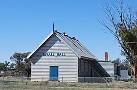 Public hall, 2009 | |||||||||||||||
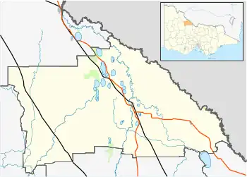  Myall Location in Shire of Gannawarra | |||||||||||||||
| Coordinates | 35°34′46″S 143°59′58″E / 35.57944°S 143.99944°E | ||||||||||||||
| Population | 98 (SAL 2021)[1] | ||||||||||||||
| Postcode(s) | 3579 | ||||||||||||||
| LGA(s) | Shire of Gannawarra | ||||||||||||||
| State electorate(s) | Murray Plains | ||||||||||||||
| Federal division(s) | Mallee | ||||||||||||||
| |||||||||||||||
Myall is a locality in the local government area of the Shire of Gannawarra, Victoria, Australia.[2]
The Stony Crossing railway line passed the western side of the locality and the Myall railway station was on that line.[3]
References
- ↑ Australian Bureau of Statistics (28 June 2022). "Myall (Gannawarra - Vic.) (suburb and locality)". Australian Census 2021 QuickStats. Retrieved 28 June 2022.
- ↑ "Map of the Shire of Gannawarra" (PDF). Retrieved 30 December 2011.
- ↑ "BORDER RAILWAYS". The Argus (Melbourne). No. 24, 454. Victoria, Australia. 22 December 1924. p. 18. Retrieved 12 July 2019 – via National Library of Australia.
External links
 Media related to Myall, Victoria at Wikimedia Commons
Localities in the Shire of Gannawarra | ||
|---|---|---|
| Town | | |
| Locality |
| |
^ - Territory divided with another LGA | ||
This article is issued from Wikipedia. The text is licensed under Creative Commons - Attribution - Sharealike. Additional terms may apply for the media files.