Old Fort, Ohio | |
|---|---|
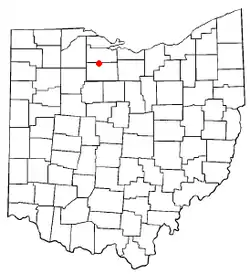 Location of Old Fort, Ohio | |
| Coordinates: 41°14′26″N 83°9′2″W / 41.24056°N 83.15056°W | |
| Country | United States |
| State | Ohio |
| County | Seneca |
| Township | Pleasant |
| Area | |
| • Total | 0.58 sq mi (1.50 km2) |
| • Land | 0.58 sq mi (1.50 km2) |
| • Water | 0.00 sq mi (0.00 km2) |
| Population (2020) | |
| • Total | 143 |
| • Density | 247.6/sq mi (95.61/km2) |
| Time zone | UTC-5 (Eastern (EST)) |
| • Summer (DST) | UTC-4 (EDT) |
| ZIP codes | 44861 |
| FIPS code | 39-58156 |
Old Fort is a census-designated place located in northern Pleasant Township, Seneca County, Ohio, United States;[2] located about a mile east of Ohio State Route 53 where N. Township Rd. 73 intersects with E. County Rd. 51. The ZIP code is 44861.[3] The population was 143 at the 2020 census.
History
Old Fort was platted in 1882, and named after Fort Seneca, a fort built during the War of 1812.[4] A post office has been in operation at Old Fort since 1882.[5]
Geography
Old Fort sits adjacent to the Sandusky River, which is a tributary to Lake Erie.
Demographics
| Census | Pop. | Note | %± |
|---|---|---|---|
| 2020 | 143 | — | |
| U.S. Decennial Census[6] | |||
Notable people
- Paul Gillmor, Republican U.S. representative representing the Ohio 5th District from 1988 to 2007.
References
- ↑ "ArcGIS REST Services Directory". United States Census Bureau. Retrieved September 20, 2022.
- ↑ U.S. Geological Survey Geographic Names Information System: Old Fort, Ohio
- ↑ Zip Code Lookup
- ↑ Baughman, Abraham J. (1911). History of Seneca County, Ohio: A Narrative Account of Its Historical Progress, Its People, and Its Principal Interests. Lewis Publishing Company. p. 472.
- ↑ "Seneca County". Jim Forte Postal History. Retrieved December 27, 2015.
- ↑ "Census of Population and Housing". Census.gov. Retrieved June 4, 2016.
Municipalities and communities of Seneca County, Ohio, United States | ||
|---|---|---|
| Cities | 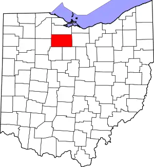 Map of Ohio highlighting Seneca County | |
| Villages | ||
| Townships | ||
| CDPs | ||
| Unincorporated communities | ||
| Ghost towns | ||
| Footnotes | ‡This populated place also has portions in an adjacent county or counties | |
This article is issued from Wikipedia. The text is licensed under Creative Commons - Attribution - Sharealike. Additional terms may apply for the media files.