Ossala | |
|---|---|
Village | |
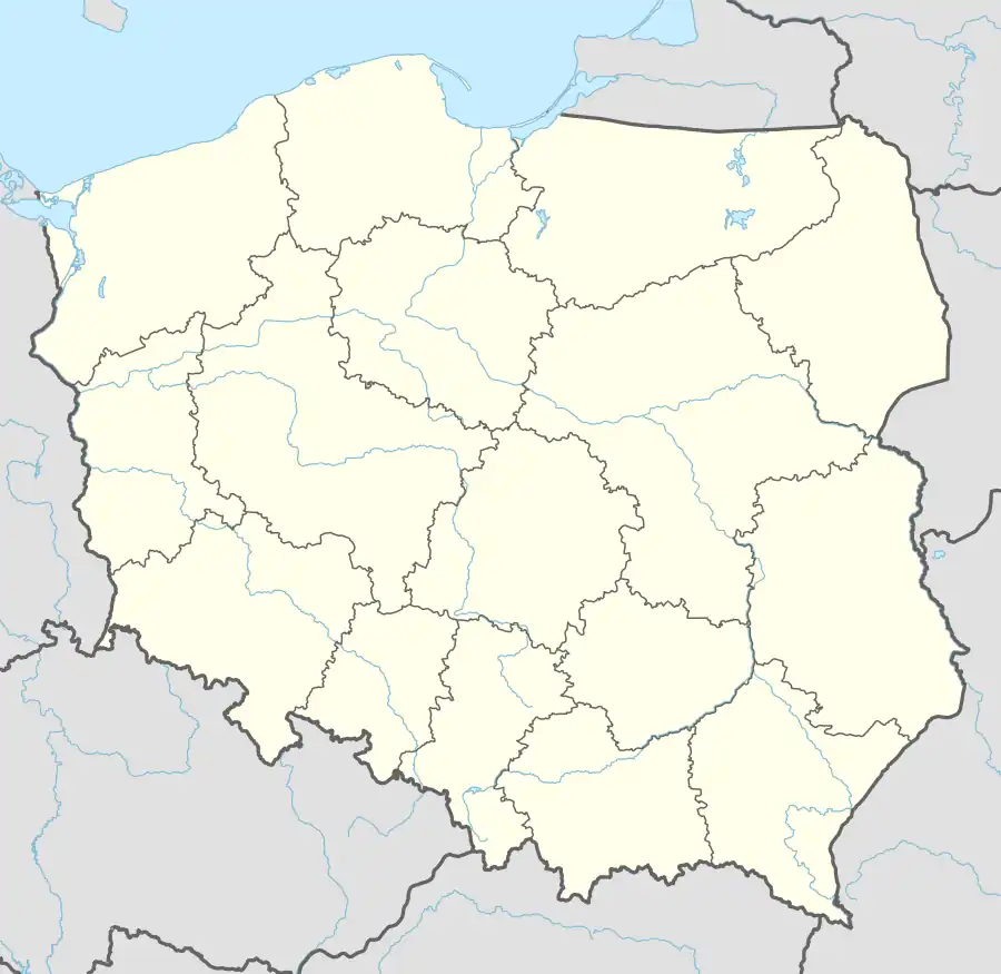  Ossala | |
| Coordinates: 50°29′06″N 21°22′20″E / 50.48500°N 21.37222°E | |
| Country |  Poland Poland |
| Voivodeship | Świętokrzyskie |
| County | Staszów |
| Gmina | Osiek |
| Sołectwo | Ossala[1] |
| Elevation | 180.1 m (590.9 ft) |
| Population (31 December 2009 at Census)[2] | |
| • Total |  481 481 |
| Time zone | UTC+1 (CET) |
| • Summer (DST) | UTC+2 (CEST) |
| Postal code | 28-221 |
| Area code | +48 15 |
| Car plates | TSZ |
Ossala[3][4] [ɔsˈsala] (till December 31, 2001 as at Osala[3][4] and then contemporary collaterant name of locality as at Ossala[4] after the official law) is a village in the administrative district of Gmina Osiek, within Staszów County, Świętokrzyskie Voivodeship, in south-central Poland. It lies approximately 7 kilometres (4 mi) south-west of Osiek, 17 km (11 mi) south-east of Staszów, and 69 km (43 mi) south-east of the regional capital Kielce.[5]
The village has a population of 481.
Demography
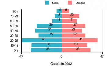
According to the 2002 Poland census, there were 454 people residing in Ossala village, of whom 50.4% were male and 49.6% were female. In the village, the population was spread out, with 25.6% under the age of 18, 40.5% from 18 to 44, 19.2% from 45 to 64, and 14.7% who were 65 years of age or older.[2]
Table 1. Population level of village in 2002 — by age group[2] SPECIFICATION Measure
unitPOPULATION
(by age group in 2002)TOTAL 0-9 10-19 20-29 30-39 40-49 50-59 60-69 70-79 80 + I. TOTAL person 454 69 64 87 54 54 56 28 28 14 — of which in % 100 15.2 14.1 19.1 11.9 11.9 12.3 6.2 6.2 3.1 1. BY SEX A. Males person 229 36 35 46 27 31 29 11 8 6 — of which in % 50.4 7.9 7.7 10.1 6 6.8 6.4 2.4 1.8 1.3 B. Females person 225 33 29 41 27 23 27 17 20 8 — of which in % 49.6 7.3 6.4 9 5.9 5.1 5.9 3.8 4.4 1.8
Figure 1. Population pyramid of village in 2002 — by age group and sex[2]
Table 2. Population level of village in 2002 — by sex[2] SPECIFICATION Measure
unitPOPULATION
(by sex in 2002)TOTAL Males Females I. TOTAL person 454 229 225 — of which in % 100 50.4 49.6 1. BY AGE GROUP A. At pre-working age person 116 61 55 — of which in % 25.6 13.4 12.2 B. At working age, grand total person 271 146 125 — of which in % 59.7 32.2 27.5 a. at mobile working age person 184 100 84 — of which in % 40.5 22 18.5 b. at non-mobile working age person 87 46 41 — of which in % 19.2 10.2 9 C. At post-working age person 67 22 45 — of which in % 14.7 4.8 9.9
References
- ↑ Rękas, Przemysław (16 January 2012). "Wykaz sołectw Gminy Osiek" [List of sołectwos of Commune and Municipality Office of Osiek]. The administrative power / An estate in Osiek and index of sołectwos (in Polish). Public Information Bulletin of Commune and Municipality Office of Osiek, Poland. bip.osiek.iap.pl. Retrieved 19 January 2012.
- 1 2 3 4 5 "Local Data Bank (Bank Danych Lokalnych) – Layout by NTS nomenclature (Układ wg klasyfikacji NTS)". demografia.stat.gov.pl: GUS. 10 March 2011.
- 1 2 Janik, Krzysztof (14 December 2001). "Dz.U. z 2001 r. nr 153, poz. 1772" [Journal of the Laws of 2001, No. 153, item 1,772]. Rozporządzenie Ministra Spraw Wewnętrznych i Administracji z dnia 14 grudnia 2001 r. w sprawie ustalenia i zmiany urzędowych nazw niektórych miejscowości w województwach: dolnośląskim, kujawsko-pomorskim, lubelskim, lubuskim, łódzkim, małopolskim, opolskim, podkarpackim, podlaskim, pomorskim, śląskim, świętokrzyskim, wielkopolskim i zachodniopomorskim oraz obiektów fizjograficznych w województwach lubelskim i lubuskim [Regulation of the Minister of the Internal Affairs and Administration of December 14, 2001 on the establishment and change the official names of localities in the provinces: Lower Silesia, Kuyavia-Pomerania, Lublin, Lubusz, Łódź, Lesser Poland, Opole, Subcarpathia, Podlaskie, Pomerania, Silesia, Świętokrzyskie, Greater Poland and West Pomerania, and physiographical objects in provinces Lublin and Lubusz] (in Polish). Warsaw, Poland: Ministry of Internal Affairs and Administration. p. 12,710.
- 1 2 3 "Ossala, wieś, gmina Osiek — obszar wiejski, powiat staszowski, województwo świętokrzyskie" [Ossala, village, Osiek Commune — rural area, Staszów County, Świętokrzyskie Province, Poland]. Topographical map prepared in 1:10,000 scale. Aerial and satellite orthophotomap (in Polish). Head Office of Geodesy and Cartography, Poland, Warsaw. 2011. geoportal.gov.pl. Retrieved 27 April 2011.
- ↑ "Central Statistical Office (GUS) – TERYT (National Register of Territorial Land Apportionment Journal)" (in Polish). 2008-06-01.
| Town and seat |  | ||||
|---|---|---|---|---|---|
| Parts of town |
| ||||
| Villages |
| ||||
| Parts of village |
| ||||
| Colony | |||||
| Hamlet |
| ||||
| Smaller locality |
| ||||