Stanton, Missouri | |
|---|---|
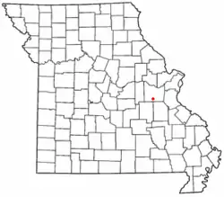 Location of Stanton in Missouri | |
| Country | United States |
| State | Missouri |
| County | Franklin |
| Area | |
| • Total | 3.27 sq mi (8.47 km2) |
| • Land | 3.27 sq mi (8.47 km2) |
| • Water | 0.00 sq mi (0.00 km2) |
| Elevation | 879 ft (268 m) |
| Population (2020) | |
| • Total | 366 |
| • Density | 111.96/sq mi (43.23/km2) |
| FIPS code | 29-70342 |
| GNIS feature ID | 2806401[2] |
Stanton is an unincorporated community in southern Franklin County, Missouri, United States.[2] It lies on Interstate 44 at the junction with Missouri Supplemental Route W, which provides access to Meramec Caverns, located approximately two miles southeast along the Meramec River.[3]
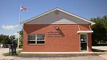
Stanton Post Office, 63079
A post office called Stanton has been in operation since 1857.[4] The community took its name from the nearby Stanton copper mines.[5]
Demographics
| Census | Pop. | Note | %± |
|---|---|---|---|
| 2020 | 366 | — | |
| U.S. Decennial Census[6] | |||
References
- ↑ "ArcGIS REST Services Directory". United States Census Bureau. Retrieved September 5, 2022.
- 1 2 3 U.S. Geological Survey Geographic Names Information System: Stanton, Missouri
- ↑ Missouri Atlas & Gazetteer, DeLorme, 1998, First edition, p. 48 ISBN 0-89933-224-2
- ↑ "Post Offices". Jim Forte Postal History. Retrieved October 1, 2016.
- ↑ "Franklin County Place Names, 1928–1945 (archived)". The State Historical Society of Missouri. Archived from the original on June 24, 2016. Retrieved October 1, 2016.
{{cite web}}: CS1 maint: bot: original URL status unknown (link) - ↑ "Census of Population and Housing". Census.gov. Retrieved June 4, 2016.
Municipalities and communities of Franklin County, Missouri, United States | ||
|---|---|---|
| Cities | 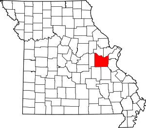 Map of Missouri highlighting Franklin County | |
| Villages | ||
| Townships | ||
| CDPs | ||
| Other communities |
| |
| Ghost towns | ||
| Footnotes | ‡This populated place also has portions in an adjacent county or counties | |
38°16′28″N 91°06′21″W / 38.27444°N 91.10583°W
This article is issued from Wikipedia. The text is licensed under Creative Commons - Attribution - Sharealike. Additional terms may apply for the media files.