| Upper Murray Western Australia | |||||||||||||||
|---|---|---|---|---|---|---|---|---|---|---|---|---|---|---|---|
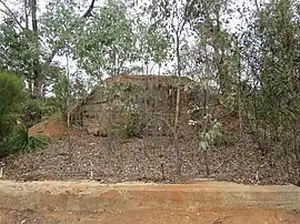 Foundations of the former Long Gully Bridge | |||||||||||||||
| Coordinates | 32°59′S 116°17′E / 32.99°S 116.28°E | ||||||||||||||
| Population | 0 (SAL 2021)[1] | ||||||||||||||
| Postcode(s) | 6390 | ||||||||||||||
| Area | 104.2 km2 (40.2 sq mi) | ||||||||||||||
| Location |
| ||||||||||||||
| LGA(s) | Shire of Boddington | ||||||||||||||
| State electorate(s) | Central Wheatbelt | ||||||||||||||
| Federal division(s) | O'Connor | ||||||||||||||
| |||||||||||||||
Upper Murray is a rural locality located in the Shire of Boddington in the Peel Region of Western Australia. The Murray River traverses the locality from its eastern to its western border.[2][3]
The Shire of Boddington and the locality of Upper Murray are located on the traditional land of the Wiilman people of the Noongar nation.[4][5]
The state heritage listed Long Gully Bridge, also referred to as Asquith Bridge and crossing the Murray River, was located in the locality of Upper Murray, but was destroyed in a bush fire in February 2015 and never rebuilt. The former railway bridge was at the time used as part of the Bibbulmun Track.[6][7]
References
- ↑ Australian Bureau of Statistics (28 June 2022). "Upper Murray (suburb and locality)". Australian Census 2021 QuickStats. Retrieved 28 June 2022.
- ↑ "SLIP Map". maps.slip.wa.gov.au. Landgate. Retrieved 11 August 2023.
- ↑ "NationalMap". nationalmap.gov.au. Geoscience Australia. Retrieved 11 August 2023.
- ↑ "Wiilman". www.boodjar.sis.uwa.edu.au. University of Western Australia. Retrieved 11 August 2023.
- ↑ "Wiilman (WA)". www.samuseum.sa.gov.au. South Australian Museum. Retrieved 11 August 2023.
- ↑ "Asquith Bridge". inherit.stateheritage.wa.gov.au. Heritage Council of Western Australia. Retrieved 11 August 2023.
- ↑ Grace, Millimaci (8 February 2015). "Bushfire claims historic bridge". The West Australian. Retrieved 11 August 2023.
This article is issued from Wikipedia. The text is licensed under Creative Commons - Attribution - Sharealike. Additional terms may apply for the media files.