Wilberton Township | |
|---|---|
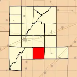 Location in Fayette County | |
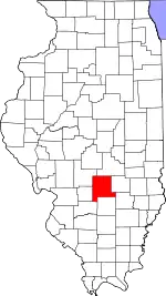 Fayette County's location in Illinois | |
| Coordinates: 38°52′00″N 88°58′37″W / 38.86667°N 88.97694°W | |
| Country | United States |
| State | Illinois |
| County | Fayette |
| Established | November 9, 1859 |
| Area | |
| • Total | 35.54 sq mi (92.0 km2) |
| • Land | 35.52 sq mi (92.0 km2) |
| • Water | 0.02 sq mi (0.05 km2) 0.06% |
| Elevation | 554 ft (169 m) |
| Population (2010) | |
| • Estimate (2016)[1] | 499 |
| • Density | 14.2/sq mi (5.5/km2) |
| Time zone | UTC-6 (CST) |
| • Summer (DST) | UTC-5 (CDT) |
| ZIP codes | 62471, 62880, 62885 |
| FIPS code | 17-051-81568 |
Wilberton Township is one of twenty townships in Fayette County, Illinois, USA. As of the 2010 census, its population was 505 and it contained 187 housing units.[2] Its name changed from Richland Township on September 24, 1860.
Geography
According to the 2010 census, the township has a total area of 35.54 square miles (92.0 km2), of which 35.52 square miles (92.0 km2) (or 99.94%) is land and 0.02 square miles (0.052 km2) (or 0.06%) is water.[2]
Extinct towns
- Augsburg
- Saint Paul
- Wilberton
Cemeteries
The township contains these seven cemeteries: Augsburg, Center, Cheshier, Crowder, Frogtown, Riedle and Saint Paul Lutheran.
Lakes
- Gatch Lake
Demographics
| Census | Pop. | Note | %± |
|---|---|---|---|
| 2016 (est.) | 499 | [1] | |
| U.S. Decennial Census[3] | |||
School districts
- Brownstown Community Unit School District 201
- Vandalia Community Unit School District 203
Political districts
- Illinois's 19th congressional district
- State House District 102
- State Senate District 51
References
- "Wilberton Township, Fayette County, Illinois". Geographic Names Information System. United States Geological Survey, United States Department of the Interior. Retrieved January 16, 2010.
- United States Census Bureau 2007 TIGER/Line Shapefiles
- United States National Atlas
- 1 2 "Population and Housing Unit Estimates". Retrieved June 9, 2017.
- 1 2 "Population, Housing Units, Area, and Density: 2010 - County -- County Subdivision and Place -- 2010 Census Summary File 1". United States Census. Archived from the original on February 12, 2020. Retrieved May 28, 2013.
- ↑ "Census of Population and Housing". Census.gov. Retrieved June 4, 2016.
External links
Places adjacent to Wilberton Township, Fayette County, Illinois | |
|---|---|
Municipalities and communities of Fayette County, Illinois, United States | ||
|---|---|---|
| Cities | Map of Illinois highlighting Fayette County | |
| Villages | ||
| Townships | ||
| CDP | ||
| Other communities | ||
This article is issued from Wikipedia. The text is licensed under Creative Commons - Attribution - Sharealike. Additional terms may apply for the media files.