Highway 39 | ||||
|---|---|---|---|---|
 | ||||
| Route information | ||||
| Maintained by Alberta Ministry of Transportation | ||||
| Length | 91.1 km[1] (56.6 mi) | |||
| Major junctions | ||||
| West end |  Hwy 22 near Drayton Valley Hwy 22 near Drayton Valley | |||
 Hwy 20 in Alsike Hwy 20 in Alsike Hwy 60 near Calmar Hwy 60 near Calmar | ||||
| East end |  Hwy 2 in Leduc Hwy 2 in Leduc | |||
| Location | ||||
| Country | Canada | |||
| Province | Alberta | |||
| Specialized and rural municipalities | Brazeau County, Leduc County | |||
| Major cities | Leduc | |||
| Towns | Calmar | |||
| Villages | Warburg, Thorsby | |||
| Highway system | ||||
|
| ||||
| ||||


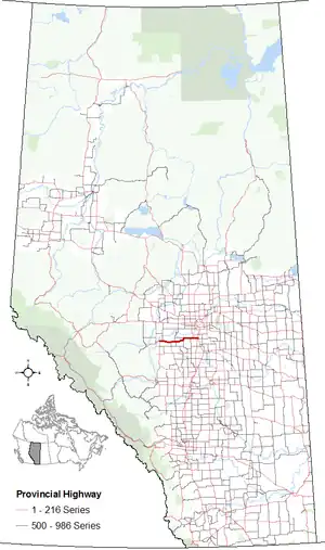
Alberta Provincial Highway No. 39, commonly referred to as Highway 39, is an east–west highway in central Alberta, Canada.[2] It extends from Highway 22, approximately 13 kilometres (8 mi) east of Drayton Valley, to Leduc where it ends at Highway 2. Highway 39 is about 91 kilometres (57 mi) long.[1][3]
Highway 39 also connects with the communities of Breton, Warburg, Thorsby, and Calmar; while most of the small communities are now bypassed, Highway 39 still travels along Main Street in Calmar.[4]
History
Highway 39 was originally constructed as a link between Leduc and Breton, where it ended at Highway 12 (now Highway 20). In 1955, a ferry across the North Saskatchewan River started operations southeast of Drayton Valley,[5] resulting in Highway 57 following present-day Highway 616 to Breton.[6] It proved to be short-lived as in 1957, the Highway 57 was realigned across a new bridge,[7] terminating with Highway 39 in Alsike.[8] In the 1960s, a 9 km (6 mi) section of Highway 39 between Breton and Alsike was renumbered to Highway 12, resulting in Highways 12, 39, and 57 once again terminating at a common point, this time in Alsike. In 1980, the Highway 22 designation was extended north, which included a 56 km (35 mi) section of Highway 57 being renumbered; the remaining 27 km (17 mi) section of Highway 57 became part of Highway 39.[9]
Major intersections
From west to east:
| Rural/specialized municipality | Location | km[1] | mi | Destinations | Notes |
|---|---|---|---|---|---|
| Brazeau County | | 0.0 | 0.0 | Hwy 22 – Drayton Valley, Rocky Mountain House | Western terminus; through traffic follows Hwy 22 north |
| 4.9 | 3.0 |  Hwy 759 north – Berrymoor, Tomahawk Hwy 759 north – Berrymoor, Tomahawk | |||
| Alsike | 26.9 | 16.7 | Hwy 20 south – Breton, Winfield | ||
| Leduc County | | 35.1 | 21.8 |  Hwy 770 north – St. Francis, Genesee Hwy 770 north – St. Francis, Genesee | West end of Hwy 770 concurrency |
| Warburg | 36.7 | 22.8 | Hwy 770 south (50 Street) | East end of Hwy 770 concurrency | |
| Sunnybrook | 44.9 | 27.9 | Range Road 22 | ||
| Thorsby | 56.1 | 34.9 |  Hwy 778 south – Pigeon Lake Hwy 778 south – Pigeon Lake | ||
| | 59.3 | 36.8 |  Hwy 622 west – Telfordville, St. Francis Hwy 622 west – Telfordville, St. Francis | ||
| 66.9 | 41.6 | Range Road 275 – Buford | |||
| Calmar | 75.0 | 46.6 |  Hwy 795 south (50 Street) – Pipestone Hwy 795 south (50 Street) – Pipestone | ||
| | 79.9 | 49.6 | Hwy 60 north – Devon | Roundabout | |
| City of Leduc | 91.1 | 56.6 |  Hwy 2 – Edmonton, Red Deer, Calgary Hwy 2 – Edmonton, Red Deer, Calgary | Interchange (Hwy 2 exit 517); eastern terminus; access to Edmonton International Airport | |
| 91.9 | 57.1 | 50 Street | To Hwy 2A south / Hwy 623 east; 50 Avenue continues east | ||
1.000 mi = 1.609 km; 1.000 km = 0.621 mi
| |||||
References
- 1 2 3 Google (January 17, 2018). "Highway 39 in Alberta" (Map). Google Maps. Google. Retrieved January 17, 2018.
- ↑ Provincial Highways Designation Order, Alberta Transportation, p. 7
- ↑ "2015 Provincial Highway 1-216 Progress Chart" (PDF). Alberta Transportation. March 2015. Archived (PDF) from the original on April 10, 2016. Retrieved October 12, 2016.
- ↑ "Community Profile". The Town of Calmar. Retrieved September 29, 2017.
- ↑ Martin, Isobel (1977). Forests to Grainfields. Berrymoor, Alberta: Berrymoor/Carnwood Historical Society. p. 133. ISBN 0-919213-36-7. Archived from the original on January 10, 2016. Retrieved September 29, 2017.
- ↑ The H.M. Gousha Company (1956). Shell Map of British Columbia, Alberta, Saskatchewan, and Manitoba (Map). The Shell Oil Company. §§ C-11, D-11.
- ↑ "Transportation Infrastructure Management System - Existing Structures in the Provincial Highway Corridor" (PDF). Alberta Transportation. September 28, 2012. p. 108. Retrieved January 26, 2017.
- ↑ Department of Highways (1960). Alberta Official Road Map (PDF) (Map). The Province of Alberta. §§ D-6, D-7.
- ↑ Travel Alberta (1980). Alberta Official Road Map (Map). The Province of Alberta.