Highway 59 | ||||
|---|---|---|---|---|
 | ||||
| Route information | ||||
| Maintained by Alberta Ministry of Transportation | ||||
| Length | 63.2 km[1] (39.3 mi) | |||
| Major junctions | ||||
| West end |  Hwy 43 northwest of Hythe Hwy 43 northwest of Hythe | |||
| East end |  Hwy 2 north of Sexsmith Hwy 2 north of Sexsmith | |||
| Location | ||||
| Country | Canada | |||
| Province | Alberta | |||
| Specialized and rural municipalities | County of Grande Prairie No. 1 | |||
| Towns | Sexsmith | |||
| Highway system | ||||
|
| ||||
| ||||


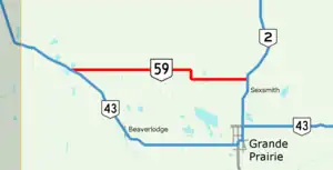
Alberta Provincial Highway No. 59, commonly referred to as Highway 59, is an east–west highway in northwest Alberta, Canada. It runs from Highway 2 north of Sexsmith to Highway 43 northwest of Hythe.[1][2][3]

Highway 59 through Valhalla Centre
Major intersections
From west to east. The entire route is in Grande Prairie County.
| Location | km | mi | Destinations | Notes | |
|---|---|---|---|---|---|
| | 0 | 0.0 | Hwy 43 – Grande Prairie, Dawson Creek | Western terminus | |
| 10 | 6.2 |  Hwy 721 south – Hythe Hwy 721 south – Hythe | |||
| Valhalla Centre | 27 | 17 |  Hwy 723 south – Beaverlodge Hwy 723 south – Beaverlodge | ||
| La Glace | 35 | 22 |  Hwy 724 south – Wembley Hwy 724 south – Wembley | Hwy 724 concurrency west end | |
| | 40 | 25 | Hwy 724 north | Hwy 724 concurrency east end | |
| Sexsmith | 62 | 39 | Hwy 2 – Rycroft, Peace River, Grande Prairie Hwy 674 east – Teepee Creek Hwy 674 east – Teepee Creek | Eastern terminus; continues as Hwy 674 | |
1.000 mi = 1.609 km; 1.000 km = 0.621 mi
| |||||
References
- 1 2 "2015 Provincial Highway 1-216 Progress Chart" (PDF). Alberta Transportation. March 2015. Archived (PDF) from the original on April 10, 2016. Retrieved October 31, 2016.
- ↑ Provincial Highways Designation Order, Alberta Transportation, p. 9
- ↑ Google (October 31, 2016). "Highway 59 in northern Alberta" (Map). Google Maps. Google. Retrieved October 31, 2016.
This article is issued from Wikipedia. The text is licensed under Creative Commons - Attribution - Sharealike. Additional terms may apply for the media files.