Highway 628 | ||||
|---|---|---|---|---|
| Whitemud Drive | ||||
 | ||||
| Route information | ||||
| Maintained by Alberta Transportation | ||||
| Western section | ||||
| Length | 19.1 km[1] (11.9 mi) | |||
| West end |  Hwy 779 in Stony Plain Hwy 779 in Stony Plain | |||
| Major intersections |  Hwy 60 in Enoch Cree Nation 135 Hwy 60 in Enoch Cree Nation 135 | |||
| East end | Whitemud Drive (Edmonton west city limits) | |||
| Eastern section | ||||
| Length | 6.4 km[1] (4.0 mi) | |||
| West end |   Hwy 14 / Hwy 216 east of Edmonton Hwy 14 / Hwy 216 east of Edmonton | |||
| East end |  Hwy 21 south of Sherwood Park Hwy 21 south of Sherwood Park | |||
| Location | ||||
| Country | Canada | |||
| Province | Alberta | |||
| Specialized and rural municipalities | Parkland County, Strathcona County | |||
| Highway system | ||||
|
| ||||
| ||||


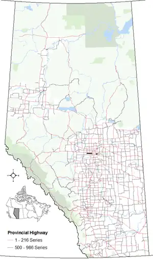
Alberta Provincial Highway No. 628,[2] commonly referred to as Highway 628, is a highway in the province of Alberta, Canada, that runs west to east through the Edmonton Capital Region in two sections. The western 19-kilometre-long (12 mi) section runs from the town of Stony Plain to the Edmonton city limits at 231 Street (Range Road 261). The eastern 6-kilometre-long (4 mi) section, also known as a Whitemud Extension, runs from Anthony Henday Drive to Highway 21 and it is just at the south of Sherwood Park.[3]
Whitemud Drive (79 Avenue west of Winterburn Road) connects both sections directly through Edmonton city limits. However, it is not signed as Highway 628 – is also known as 79 Avenue in Stony Plain.
Major intersections
From west to east:
| Rural/specialized municipality | Location | km[1] | mi | Destinations | Notes | ||
|---|---|---|---|---|---|---|---|
| Parkland County | Stony Plain | 0.0 | 0.0 | Hwy 779 (48 Street) | Hwy 628 western terminus; continues as Township Road 524 | ||
| 1.2 | 0.75 | Golf Course Road | |||||
| | 6.1 | 3.8 | Range Road 273 (Golden Spike Road) – Spruce Grove | Former Hwy 788 | |||
| Enoch Cree Nation 135 | 15.8 | 9.8 | Hwy 60 (Devonian Way) – Acheson, Devon | ||||
| City of Edmonton | 19.1 | 11.9 | 231 Street (Range Road 261) | Hwy 628 eastern terminus; continues as Whitemud Drive | |||
| Gap in Highway 628; see Whitemud Drive § Exit list | |||||||
| Strathcona County | | 47.3 | 29.4 | Anthony Henday Drive (Hwy 216) / Hwy 14 east – Wainwright | Interchange, Hwy 216 exit 64; Hwy 628 western terminus | ||
| 48.8 | 30.3 | Range Road 233 – Sherwood Park | |||||
| 53.7 | 33.4 | Hwy 21 – Fort Saskatchewan, Sherwood Park, Camrose | Hwy 628 eastern terminus; continues as Township Road 522 | ||||
| 1.000 mi = 1.609 km; 1.000 km = 0.621 mi | |||||||
Template:Attached KML/Alberta Highway 628
KML is not from Wikidata
References
- 1 2 3 Google (April 2, 2018). "Highway 628 in Alberta" (Map). Google Maps. Google. Retrieved April 2, 2018.
- ↑ Provincial Highways Designation Order, Alberta Transportation, p. 20
- ↑ 2017 Provincial Highways 500 - 986 Progress Chart (PDF) (Map). Alberta Transportation. March 2017. Retrieved April 2, 2018.
This article is issued from Wikipedia. The text is licensed under Creative Commons - Attribution - Sharealike. Additional terms may apply for the media files.